
Regional Arctic System Model (RASM) - Regional Arctic System Model (RASM)
Predictions
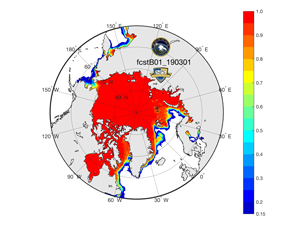
Arctic sea ice is a sensitive indicator of the state of Arctic climate and its polar amplification. However, the causes of Arctic ice melt and its rate are not fully understood. Global climate models (GCMs) vary widely in their predictions of warming and the rate of Arctic ice melt, suggesting it may take anywhere from a couple of decades to more than a century to melt most of the summer sea ice cover. The multi- model average forecast based on results from the Intergovernmental Panel for Climate Change Fourth Assessment Report (IPCC-AR4) predicts a 50% reduction of summer sea ice in the Arctic Ocean by the end of this century. Unfortunately, the majority of those models have significant limitations in their representation of past and present sea ice variability in the Arctic. Some of the critical limitations include: sea ice thickness distribution, deformation, variability and export, air-ice-sea interactions, northward oceanic/atmospheric heat convergence, and freshwater export. This proposal intends to target potential causes of those limitations associated with resolution and sophistication of ocean-atmosphere boundary layers and their interaction with and without the sea ice cover. The recently developed high-resolution Regional Arctic System Model (RASM) will be used as a tool for numerical simulation and synthesis with in-situ and satellite observations to investigate the critical physical feedback processes and interactions between the atmosphere, ocean, and land under a diminishing sea ice cover. View the Interactive Predictions Model.
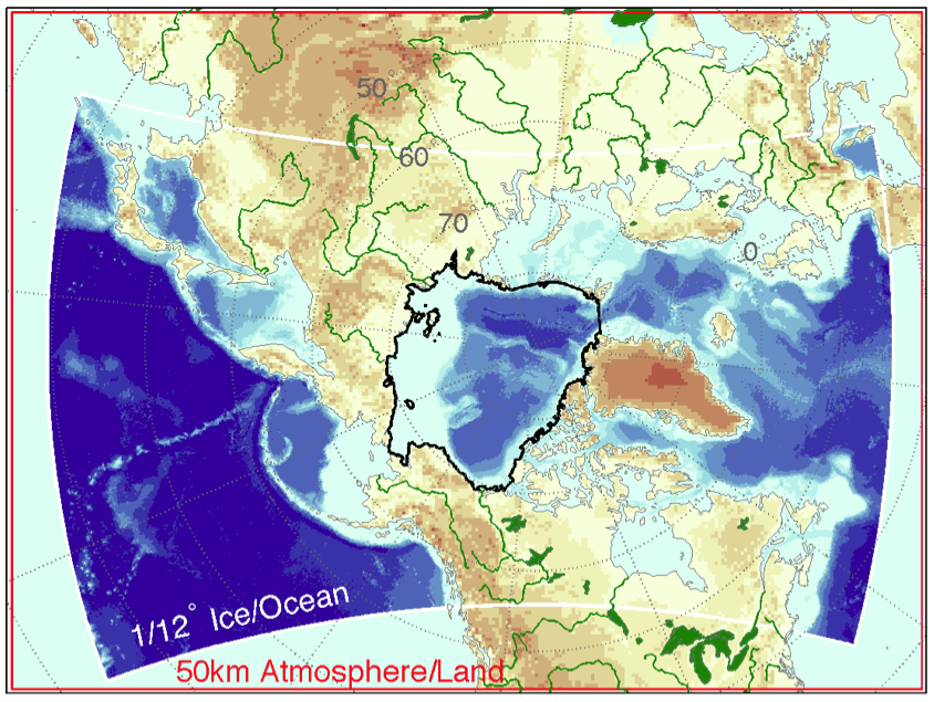
RASM is a limited-area, fully coupled ice-ocean-atmosphere-land model that uses the Community Earth System Model (CESM) framework.